Map of the 18 Stations
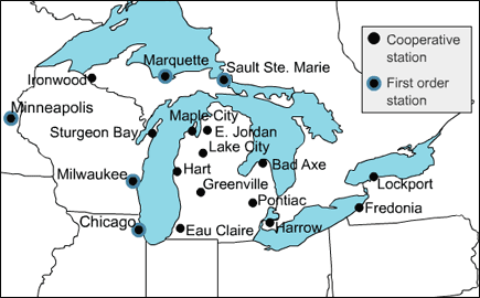
The stations selected were a combination of Cooperative and first-order weather stations (see legend on the map). When available, wind and humidity observations were also collected from nearby first-order stations in order to calculate the Heat Index (HI) and Wind chill, which may be accessed from the Historical Weather Tool.
Additional Information:
- Cooperative (COOP) weather/climate station network
- First-order weather station
- Heat Index (HI)
- Wind chill
RETURN TO: Historical Climate Trends ![]()